Showing posts with label Bike Camping- Yes. Show all posts

Wednesday, December 09, 2020

Smith River Collection

The Smith River in Del Norte County, California has a vast network of gravel roads and mountain bike trails.  The Smith River Guide produced by the Six Rivers National Forest is an excellent resource and includes an overview map as well as descriptions of all the mountain bike trails.  One major note- the guide shows a permanent road block on the 17N05 road, which was repaired the fall of 2020.  This is an important road to access the Bear Basin Lookout from Highway 199 or to complete various gravel loops.  Some of the scenic drives in the guide make good gravel exploration rides.  

There are many reasons to visit the Smith River including:


Amazing forests of old growth trees and rare plants to view along your ride


Great swimming spots in crystal clear water after a hot ride


Scenic vistas at fire lookouts make great cycling destinations


Multiple campgrounds making great base camps or bikepacking stops


I started a Smith River Collection of routes on ridewithgps.  This is a new format for me.  Instead of describing each ride here as a separate blog post, the rides are grouped by zone and described in ridewithgps.  I'm focusing on gravel and mountain bike routes in the Smith River Collection. 


Monday, December 07, 2020

Smith River Lighthouse to Lookouts Bikepacking Route

Distance:  144 miles

Climbing: 25,540'

Difficulty: Epic


    The Smith River in Del Norte County, California is a hidden gem located in the extreme northwest corner of the state on the California-Oregon border.  The route travels through state and national parks as well as two national forests including Jedediah Smith Redwoods State Park, Redwood National Park, Smith River National Recreation Area of the Six Rivers National Forest, and a small portion of the Rogue River-Siskiyou National Forest.  Beginning at Battery Point lighthouse on the coast, the route heads straight out of Crescent City to an ancient coast redwood forest.  Within 4 miles the route turns to gravel as it winds through a grove of giant redwoods in Jedediah Smith Redwoods State Park.  The forest habitats along the route have a high variety of conifer species and unique plants due to diverse topography, geology, and climate.

  • The route crosses all three forks of the Smith River, which is known for its crystal clear water, amazing swimming holes, and abundant native fish and wildlife. The Smith River was added to the National Wild and Scenic Rivers System in 1981.  It is an undammed and free-flowing river.
  • There are many camping options including a backcountry camp, developed campgrounds, dispersed camping, and the Bear Basin Butte USFS rental lookout
  • Two existing forestry fire lookouts provide spectacular views
  • The route utilizes a network of USFS gravel roads that are generally well maintained with several route options.  The route avoids major highways and is limited to less than 1 mile of highway travel.
  • There is year-round water throughout a majority of the route
  • Elevation ranges from sea level to just over 5,000 feet. Recommend riding from June to October due to potential for snow at higher elevations. Prime time is July to September to take advantage of warm temperatures and swimming opportunities
  • Summers are dry and warm with temperatures ranging from 80-100 F. The rainy season from October to April has an average annual rainfall of 90 plus inches
  • The route is climbing intensive with several extended climbs. Recommend ample mountain bike gearing and minimum 2” tires for the singletrack and some rough gravel sections.
  • Recommend 3-5 days, but your YMMV

Monday, July 06, 2020

Lost Coast Tour

Update: July 6, 2020

I toured this route again on a two day overnighter that included a dirt route from Ft. Bragg to Willits. If you’re interested in that route check out the Sherwood Road post.  This time I was on a proper bikepacking bike, a Salsa Cutthroat, which left no doubt that a mountain-style bikepacking bike is the best choice.  You could complete the route on a loaded gravel bike or touring bike but fit the largest tires possible and make sure to have mountain style gearing.  I was running a 32x46 low gear and only walked a couple of sections. I was able to bomb the steep dirt sections with confidence on 29x2.2 tires and disc brakes.   I’m leaving my original post below intact because it is still accurate, except for a few changes I noted:

  • There is no water at Tolkan campground.  The water system is broken and appears to be permanently decommissioned.  I chose to ride on to Wailaki campground.  Here there is water but you have to filter it from the creek.  
  • Bring a water filter.  I found really nice springs on Kings Peak road after crossing Bear Creek.  There is also a spring on Usal Road between Wailaki Campground and Usal Beach Campground.  
  • Below is the route starting in Eureka at Herrick Avenue on the south side of Eureka.


Original 2011 post describing the route starting in Ferndale.

Cumulative Distance: 93.65 miles
Cumulative Climbing: 14,768 feet
Difficulty: Epic
Type: Mixed, 37 miles of dirt roads
Start: Ferndale


The Lost Coast Tour is an alternative to touring down Highway 101, the Avenue of the Giants, and Highway 1 between Eureka and Fort Bragg. The tour can be included in your coastal tour or completed as a fun short tour that can be made into a loop or a point to point. I completed the ride in the summer of 2011 as a counter clockwise loop from Eureka to Usal and returning via Leggett and Highway 101.

The Lost Coast is shrouded in mystery, myth, and adventure. This post provides a reasonable way to complete the tour including recommended equipment, distances, and stops. I'm sure a maniac could complete it in one day, but I recommend at least 3 days. I believe any experienced cyclist can complete the tour if you are patient and pace yourself.

Here are my recommendations for equipment. I'm sure you could complete the ride on most any bike, but some would be better than others. I would not recommend a road racing bike with narrow tires and overloaded rear rack. A mountain bike or touring bike with ample gearing and wide tires is mandatory. I completed the ride on a loaded steel touring bike with a triple crankset, mountain bike cassette, 650B x 42mm Grand Bois Hetre cushy tires, 40 pounds of gear, 4 water bottles, and spare parts. At times I wished I had ridden my 29er and gone for a superlight off-road setup. There were times when I really wanted to bomb the gravel road descents, but had to carefully pick my lines and control my speed to avoid crashing or pinch flatting.


  • Make sure your bike is in great mechanical condition.

  • Choose reliability over speed.

  • Have extra water carrying capacity such as multiple bike bottles or a hydration pack. Water stops are critical strategic points. Don't pass one up without filling up. It's a good idea to bring a water treatment system such as a filter.

  • Bring extra food. There are only two stores and they are located early in the ride.

  • Don't rely on a cell phone for safety. I had poor cell coverage for most of the ride.

  • Let someone know your route and stick to it.

  • Bring enough clothes to cope with extremes in temperature. I experienced cold 47 degree drizzle to temperatures in the 90s.Don't do this ride in the winter. The Usal road is not maintained during the winter and would be impassable because of the sticky clay surface.


The following are some route recommendations and directions. I won't be overly-detailed, so the ride will still have some adventure left for the rider who chooses to follow these directions. The best advice I read was from John Zilly’s book “Wild Pigs: The Mountain Bike Adventure Guide to the Pacific Coast,” where he describes this same route. If you are used to 100 mile days on a road tour, expect only 30 mile days on the Lost Coast.


DAY 0- Eureka to Ferndale Distance: 16.65 miles
Climbing: 694 feet

The real starting point for the Lost Coast is Ferndale. The ride from Eureka to Ferndale can be easily accomplished by riding down 101, taking the Ferndale exit and following the signs to Ferndale. However, if you want to avoid riding on the Highway as much as possible, follow this description.

0- Start, Herrick Avenue Exit, Highway 101
3.8- Exit 698 for Tompkins Hill Rd toward College of the Redwoods
4.3- Right towards College of the Redwoods
6.9- Right on Hookton Road, turn right and continue over Highway on overpass
7.2- Continue straight on Eel River Drive, don't get on the Highway
9.8- Loleta, Straight or turn left on Loleta Drive to the Loleta Cheese Factory or Loleta Bakery
11.6- Right on Fernbridge Drive towards Fernbridge
12.2- Right on CA-211 towards Ferndale
16.0- Turn right onto Van Ness Ave towards the Fairgrounds, or straight into town for supplies
16.5- left onto 5th street
16.65- Arrive at the Humboldt County Fairgrounds

The camping at the fairgrounds is simple and cheap, but there are warm showers and lots of good restaurant options downtown. Plus, this is the best place to start since it is only 3/4 of a mile from the start of the route.


REFER TO THE ROUTE SHEET FOR TURN BY TURN DIRECTIONS

DAY 1- Ferndale to A.W. Way Campground
Distance: 35 miles
Climbing: 4520 feet


The day starts off with a climb up the Wildcat/Mattole Road. The road is narrow, but there is little traffic and the drivers are polite. If this steep paved climb makes you doubt your fitness, you have not seen anything yet. You should consider turning around because the dirt roads in the King Range are much more challenging. There are two big climbs on the route within the first 20 miles. The first climb tops out at 1909 feet at the 7.2 mile mark. The descent into Capetown will challenge your brakes and descending skills. If you have weak brakes now, consider turning around or adjusting them. The dirt roads in the King Range are much steeper. The next climb isn’t as long, but there are a series of tough switch backs and uneven pavement that will test your bike handling and climbing skills. You get to bomb down the 18 plus percent “Wall” on the way down to the ocean. This is a nice treat if you are used to climbing the Wall during the Tour of the Unknown Coast.

After a nice tailwind along the ocean you head inland climbing towards Petrolia. At mile 29.6, stop at the Petrolia store for supplies. They have a small market with basic supplies, but can also make great deli sandwiches. You are in store for more climbing before you reach A.W. Way. At mile point 30.6 you will turn left after crossing the Mattole River. An alternative camp site is located down Lighthouse Road on the ocean at the Mattole Campground

As you head east along the Mattole River you will be challenged by the last significant climb of the day, the “Dump Hill” at mile point 33. There are a couple of tough switchbacks that will have you fighting your bike. From here it is an easy ride into A.W. Way Campground at mile point 36. The campground has recently been upgraded with a brand new bathroom and hot showers! Pushing on to the Honeydew Creek campground is a mistake. A.W. Way has a nice swimming hole and there are several river-front camping sites to pick from. In contrast, Honeydew Creek is smaller, less private, and has no potable water. There are no showers or flush toilets like A. W. Way.


Day 2- A. W. Way Campground to Wailaki Campground
Distance: 30.5 miles
Climbing: 4921 feet

Today you will get your first taste of gravel road touring. The ride to Honeydew Store at mile marker 8.1 is fairly uneventful with a couple of small climbs. Stock up on water and supplies at the Honeydew store before heading into the wild. The real challenge begins just after the 10 mile mark on Wilder Ridge Road. The road starts to climb and switchback at perhaps the steepest grade so far. A 0.4 mile gravel switchback section challenges you to keep you front wheel from washing out and your rear wheel from loosing traction. After 11.6 miles, the slope becomes more gradual, but the climb continues all the way to Kings Peak Road at mile point 15.8.

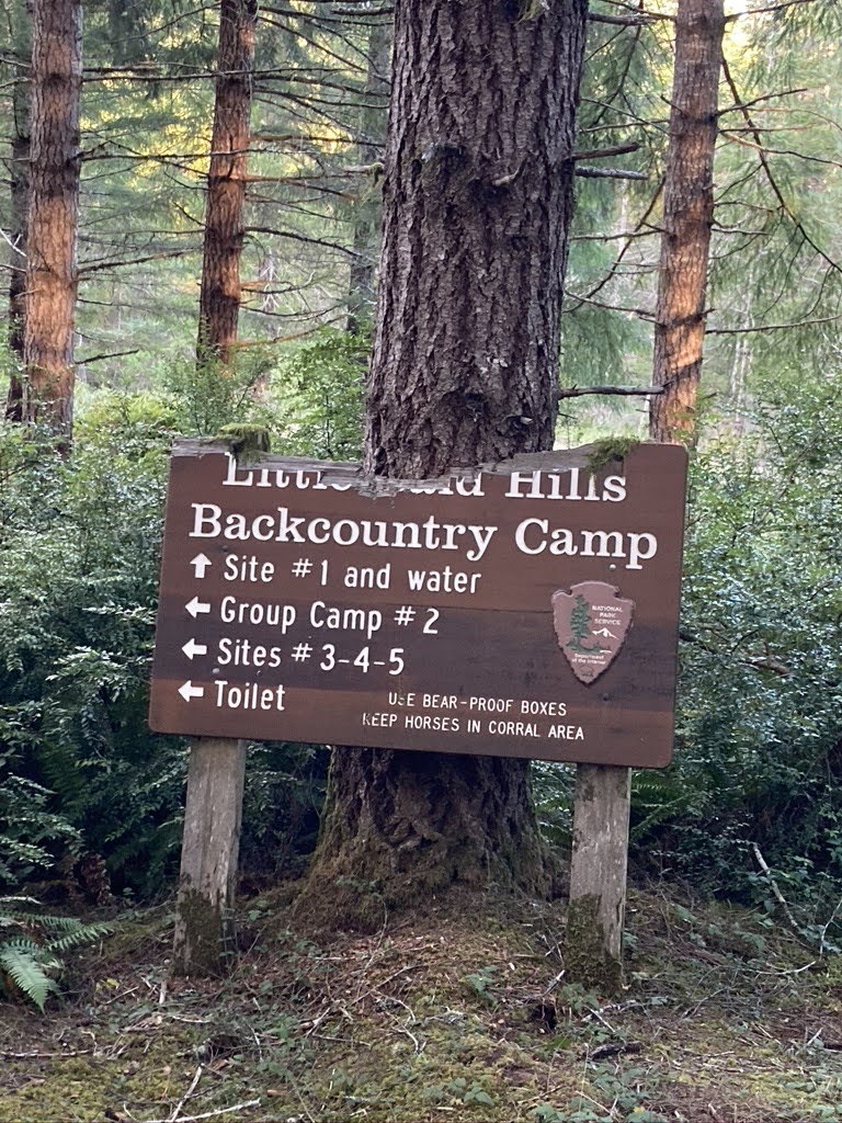
Now the real challenge begins on a steep gravel descent to Bear Creek. Your brakes and handling will be challenged as you try to avoid washing out on the tight switchbacks. I once turned back here afraid of what I was in for. Be happy that you don’t have to climb this beast of a road. The only car I saw on this whole dirt section was a Toyota Landcruiser. As I passed them I saw a curious look in their eyes as I bombed down the rutted road on a touring bike. The rough road will challenge you as you steadily climb above Bear Creek and cross several small creek fords. Pass up Horse Mountain Campground for Tolkan, where there is potable water (Update, June 2020, water system broken). This is a great base camp if you want to ride the Paradise Royale mountain bike trail.

From here the climbing continues until you reach Shelter Cove Road at mile point 28.1. If you are short on supplies, it is a tough decision to ride all the way down the descent to Shelter Cove. It’s a little over 3 miles, but it means a tough ride back out. Turn left on Shelter Cove Road and head out Chemise Mountain Road to Wailaki Campground. The nice smooth pavement, shade, and gentle topography are a welcomed change. Wailaki is an important stopping point with nice camp sites along the South Fork of Bear Creek. This is a great place to rehydrate and rest before conquering the ride to Usal. If you choose to push on like I did, expect to spend a long day in the saddle, even though it’s only 22 miles to Usal Beach Campground. It took me nearly 4 hours at a meager pace of 6 miles per hour.

Day 3- Wailaki Campground to Usal Beach Campground
Distance: 23 miles
Climbing: 4025 feet

I had heard rumors about the Usal Road being the worst road on this whole ride. I also heard stories of vehicles getting stuck on the unmaintained road during the winter. The Usal Road lived up to its reputation, but it is totally rideable during the summer. The road varies from hard packed clay to loose gravel. Along the way you will have to pick good lines between ruts left from 4x4s and the small erosion gullies left from winter weather. The road is not maintained in the winter, but it didn’t appear like it was maintained during the summer either. If you are a mountain biker, this will seem like a normal fire road or logging road ride. Riding 23 miles on an unloaded mtb would be less of a challenge. But, it is demanding if you are trying to control a loaded touring bike. During this ride I saw only one SUV and two motorcycles. You will be out of cell phone range and away from help, so ride cautiously!

Chemise Mountain road sounds like a barren and hot ride. However, both Chemise Mountain Road and the Usal Road are covered by a nice canopy of second growth Douglas-fir and tanoak the majority of the way, which provides lots of shade.

At mile point 0.95 you will be greeted by a steep gravel descent. After this white knuckle experience you will love the paved rolling terrain for a couple of miles as you pass the community of Whale Gulch. The real peace and isolation starts when you ride up the narrow and twisting Usal Road 4.5 miles into the ride. There are few landmarks along the way as you seem to continuously climb on the narrow dirt road. After 19 miles of climbing and ups and downs you will bomb down to the Usal Beach Campground, part of the Sinkyone Wilderness State Park

This simple campground features private camp sites up Usal Creek, along the beach, or within a small prairie. There is no potable water here, but water may be available in Usal Creek if you have water treatment options.


Day 4- Usal Beach Campground to Highway 1 and Beyond

If you choose to push on or spend the night, you have 5.5 miles and 1300 feet of climbing to reach Highway 1. Fort Bragg is an additional 28 miles further.
Here are some more resources:


  • BLM King Range Information HERE

  • Sinkyone Wilderness Information HERE

  • Asana Cycling Surly Big Dummy Tour has a fun description of the ride and some video of the adventure

  • John Zilly's "Wild Pigs: The Mountain Bike Adventure Guide to the Pacific Coast" published in 1995 details the route. I used this for my adventure. The only real changes are there are a couple sections of road that have been paved since 1995. It details mountain bike rides all along the west coast and is available at Amazon

  • Amy L's Northern California Bike Loop Advice Blog where she road the Usal road from south to north and then headed east towards Redway.

Sunday, June 21, 2020

Somes Bar Gravel Loops

Distance:  20-50+
Elevation:  3,669’-7,000’+
Difficulty: Hard
Start:  Somes Bar, California

The Klamath National Forest near Somes Bar, CA, has miles and miles of backroads to explore as well as great campgrounds.  The Klamath and Salmon Rivers are a bonus for a great cool down after a long bike ride.  Plus there are remote backcountry campsites perfect for bikepacking or backpacking adventures.  Shown below are two loops that start and end in Somes Bar at the Somes Bar Outpost.  These are just two examples of the potential riding the area has to offer.  You could ride them in any direction, skipping, or adding the lookouts along the way.  I haven’t provided a ton of turn by turn directions so you can choose your own adventure.  I do recommend a gravel bike or a mountain bike with good climbing gears.  There are springs and streams along the way so bring your water filter.  Summer temps can reach into the 90s.


Offield Mountain Lookout (site) Loop

This 20 mile loop includes a few miles of Highway 96.  It can be completed clockwise or counterclockwise.  If you do it clockwise you will do the highway segment first, climb up gravel road 12N52, and descend on paved Camp Three road.  If you do it counterclockwise, the climbing is easier on the pavement, you descent gravel, but have to ride the highway back.  There are pros and cons to each way.  The Offield Mountain Lookout is an optional out and back (1.5 miles each way) with a steep grade up to the old lookout site. There is no longer a lookout at the location, just a rock monument.  There are however great views on the way up to the site. It makes a good picnic stop halfway through the ride.


Ukonom Lookout Loop

This 53 mile loop is tough with over 7,000 feet of climbing.  It would make a great overnight bikepacking trip.  There is a nice campground with picnic tables at Stanshaw Campground on the edge of the Marble Mountain Wilderness.  You could camp there and then hike into the wilderness from the trailhead located a the campground.  We did discover a slide at about road point 40, but you can safely walk across the creek.  The lookout is a permanent structure that is staffed during fire season.  It is a 4 mile one-way ride out to the lookout with a steep final climb.


Monday, June 15, 2020

MTB- Ossagon Trail

Distance: 18.5 miles
Climbing: 1347 feet
Difficulty: Moderate
Start: Prairie Creek Redwoods State Park, Orick

Updated June 15, 2020

I road this loop recently and found it more challenging than it used to be.  Where the Ossagon trail meets the Coastal trail, the route is very difficult to find due to multiple elk trails and lack of maintenance.  Also, the Ossagon hike/bike-in campsite is no longer maintained for camping.  Just a warning that the route may turn into an adventure.


Original Post
This popular mountain bike loop has a lot variety. It travels through old growth redwood forest, coastal Sitka spruce forest, prairie, and along the beach. The route travels along 6 miles of paved roads before turning to 5 miles of singletrack and 7.5 miles of gravel/dirt roads. The riding is not very technical, but a lot of fun, especially the Coastal Trail which has some fast twisty singletrack. There are areas of special interest such as a cool waterfall, Fern Canyon, and Gold Bluffs beach. You can't avoid getting wet because there are several creek crossings and a particularly troublesome swampy area along the beach. If you choose, you can also camp out along the way.

To get to the start head 40 miles north from Arcata to Newton B Drury Scenic Parkway. Go approximately 1.2 miles and turn left and park near the visitors center. You may be lucky to view a herd of Roosevelt Elk grazing in Elk Prairie.
  • 0- Head north on Newton B Drury Scenic Parkway
  • 5.68- Turn left on the Ossagon Trail
  • 7.38- Cross the creek and take the first trail left, which is the Coastal Trail.

  • 7.42- Take the first trail left through a swampy area.

  • 7.75- Continue straight at the West Ridge Trail intersection.

  • 8.75- Stop to check out the cool 100 foot waterfall.

  • 10.11- Stop to check out Fern Canyon. Bear left to stay on the trail.

  • 10.36- End of the Coastal Trail and beginning of Davidson Road. There is a bathroom located in the parking area at the end of Davidson Road. Continue approximately 4.8 miles along Davidson Road until you turn onto the trail back to the Elk Prairie Campground.

  • 15.17- Left onto "bicycle/jogging" trail. The trail is an old road that has overgrown into fast singletrack.

  • 16.25- Straight over the bridge and continue on dirt road.

  • 16.97- Left on road

  • 17.2- Right on road

  • 17.35- Go through the gate and turn left proceeding through the second gate. Follow the signs back to the start at Prairie Creek Redwoods visitors center.
Click on the map to see a larger view or print it out. The trails are well marked and the map has the major turning points marked for reference.

Sunday, December 29, 2019

MTB- Tish Tang

Distance: 18
Climbing: 3,826 feet
Difficulty: Hard
Start: Willow Creek

UPDATE December 29, 2019
The trails have not seen regular maintenance and/or have been obliterated by logging.  The Corral trail, Shale trail, and Roller trail are unrideable.  The main roads are still open for a good gravel exploration ride and you can still  hit the downhill trail on the way back out.  I’m preserving the original text below, but be warned it has not been revised.

The Tish Tang DH and access road are on Trailforks but not on MTB Project.

This is a popular mountain bike ride, which is about an hour drive east of Arcata. The course is covers the majority of the expert race course from the old Tish Tang Mountain Bike Race. The trail was established and maintained for many years by Willow Creek mountain bike pioneer John Dostal.

To get to the start take Highway 299 to Willow Creek. Turn north onto Country Club Road, which is the cross street at the Chevron gas station. At 0.9 miles turn left on Patterson Road. Continue on the main road which will pass the Bigfoot Golf Course and wind its way into the forest. At 3.4 miles the road narrows so drive carefully. At 5.1 miles continue straight on Forest Service road 8N03 towards Horse Linto Campground. From this point on the road is poorly maintained. During the winter of 2008 a slide deposited on the road, which is still passable with a 4X4 vehicle or vehicle with good clearance. Horse Linto Campground is located next to Horse Linto Creek and is a simple pit toilet site with no running water. There are three campsites if you choose to spend the night in bigfoot country.

Listed below are some map points. The distance between each point is shown as well as the distance to some of the points from the Horse Linto Campground. Here is what each point represents:

1- Bottom of the downhill trail.
2- Bottom of the roller trail.
3. Intersection of the downhill trail.
4. Intersection of the 8N37 road.
5. Top of the roller trail.
6. Sign Board Gap.
7. Intersection with 7N09 road.
8. Intersection with 8N03T road.
9. Turn right on singletrack beyond the corral.
10. Bottom of singletrack and intersection with 7N09 road.

The most popular ride would be to climb the fire road all the way to the corral trail at point 9, descend down the corral trail to point 10, climb back up to point 7, descend to point 5 on the fire road, take the "roller trail" from point 5 to point 2, ride up to point 3, descend down the "downhill trail" to point 1, and return to the campground. This would give you a total of 18.2 miles and 3826 feet of climbing. However, there are several other trails that are worth checking out. The shale trail is accessed from sign board gap on the 8N14 road. The upper section is steep with a loose shale surface which is very challenging. The upper downhill course is steep and challenging as well. I don't highly recommend it because of its steepness and low frequency of maintenance.


Tish Tang A Tang Map Overview, Click on the image for a larger view or to print it out in landscape view:


Horse Linto Campground:


The top of the roller trail is difficult to find because of recent logging. Look for a large oak tree with a burned out hollow in the base. Head straight downhill to the right of the oak tree and you will pick up the singletrack.


At the top of the corral trail you will enter an old growth Douglas-fir forest:


The main fire road has seen little to no maintenance by the Forest Service and is starting to revert back to nature. At some point we are going to have to clear the main road too:

Sunday, January 18, 2009

MTB- Paradise Royale

Distance: 12 miles
Climbing: 2610 feet
Difficulty: Moderate
Start: King Range, Tolkan Campground, Shelter Cove


This is the best legal mountain bike ride in Humboldt County. The trail was built with over 4,000 hours of volunteer help. Unlike other rides on my blog, there is good information on the web about this ride including an IMBA article and a BLM Opening Ceremony article . The BLM also has a nice route map which I have posted below.


To get to the start, drive approximately 22 miles west on the Briceland/Shelter Cove Road from Redway. Turn right on King Peak Road and drive approximately 3.5 miles north to Tolkan Campground. There is a trailhead closer to Shelter Cove Road, but the campground has toilets and is located off the dirt road where your car won't get quite as dusty.

The most popular way to do the ride is clockwise, descending down Castle's Moat to Bear Creek and climbing up Prince of Pain. The real payoff is the descent of Mad Queen's Careen, which is a swoopy singletrack with jumps and fast turns. The trail is marked really well so I have not included a que sheet. Just print out the BLM map, follow the trail, and have fun!!!! My GPS showed 12 miles and 2610 feet of climbing. The BLM article states the trail is 14 miles long. I can't explain the difference, but have heard from a couple of other riders who have measured it at 12 miles too.

Click on the Garmin Connect link for a map and other ride details:

Garmin Connect - Activity Details for Paradise Royale


WARNING, you have to cross Bear Creek two times. During the winter swift waters could be hazardous. There is no bridge so be careful.


There is an excellent map in Adobe PDF on the BLM website:


Friday, January 09, 2009

MTB- Grasshopper Peak Lookout

Distance: 14 miles
Climbing: 3350 feet
Difficulty: Moderate
Start: Humboldt Redwoods State Park, Weott

6.66 MILES TO THE TOP


This is one of those rides that you do once to check off your list. If you are deciding between this and Look Prairie/Thornton Loop, choose the later. This is because the climb is really steep and particularly aggravating. It might be worth it if there was 10 miles of sweet singletrack waiting for you at the top, but there is not. Maybe I was just having a bad day, but I saw my GPS read 30% a couple of times as I granny ringed it up a steep climb at 2.5 miles per hour. I cursed the climb and threatened to turn around more than once. When I got to the top my GPS read 6.66 EVIL miles. If you do this ride, please don't curse me, because I warned you! I rated the difficulty as moderate because of the steep climb, but it is a short ride and technically easy since it is all fire road.

Once you get to the lookout you have a 360 degree view. If you look to the east you will see signs of the 2003 Canoe fire, which started from lightning. The fire burned particularly hot near the lookout. There are many miles of roads to explore throughout the area if you want to extend your mileage. Most folks will settle for a fast ride back down the road. However, for the adventurous there are a couple of simple backcountry trail camping sites you could use. There is Grasshopper Trail Camp, Hanson Ridge Trail Camp, Whiskey Flat Trail Camp, and Johnson Trail Camp. For more information contact Humboldt Redwoods State Park

Directions to the start:

Start at the base of Grasshopper Road, which is located 5.25 miles west of Highway 101 on Bull Creek Road. There is a sign on Bull Creek Road which says "fire lookout 7 mi." The road is just west of the entrance to Albee Creek Campground. There is a small parking area on Bull Creek Road and and a small parking area a little way up Grasshopper Road. The directions to the lookout are well marked at each intersection. There are only three turns:
  • At 0.72 miles stay left at the intersection of Squaw Creek Ridge Rd.
  • At 4.14 miles stay right at the intersection of Johnson Trail Camp Rd.
  • At 6.33 miles stay right at the intersection of Grieg Rd.


Squaw Creek Bridge Crossing (Click for Larger View)


Monday, July 14, 2008

MTB- Look Prairie Thornton Loop

Distance: 13 miles
Climbing: 2,762 feet
Difficulty: Moderate
Start: Near Weott


Humboldt Redwoods State Park is located approximately 40 miles south of Eureka. There are miles of awesome singletrack. Unfortunately, most of the trails are off limits to mountain bikes. This loop includes the best legal single track in the park, which is the Thornton multi-use trail (MUT). The ride will take you through prairies, second growth redwood forests, and old growth redwood forests. The climb up Look Prairie road is very difficult. In fact, every time I have climbed this route I have wondered why I do it. However, the remainder of the ride will soon make you forget the difficult climbing.

0- Start at the base of Look Prairie Road, which is located 4.3 miles west of Highway 101 on Bull Creek Road or 0.7 miles east of the entrance road to Albee Creek Campground. A great way to do this ride is to campout at Albee Creek Campground. The Look Prairie Road starts out as a gravel road which winds its way up through the prairie at a reasonable grade. However, the gradient quickly steepens. This is not a good single speed ride and beginners may find themselves walking short sections. It took me a full hour to climb 4 miles and I lost traction and had to hop off my bike a couple of times. About half way up the climb you enter old growth redwood forest and the road feels more like a wide leaf covered trail. The upper third of the climb is not as steep and is more enjoyable.

3.45- Left on Peavine MUT and continue climbing for another half a mile.

4.0- Descent! You have reached the top of the ridge and the first descent. You will travel along the top of the ridge which climbs and descends along the Peavine trail.

6.85- Left on Thornton MUT. You will have 5 miles of fantastic single track descending. The route is well planned and descends at a gradual rate as it twists and turns through the forest.

11.83- CAUTION gate ahead. Be careful on the steep descent to Albee Creek Campground because there is a gate at the end of the trail.

11.89- Turn left at the campground check-in station and travel over the bridge and head back to Bull Creek Road.

12.2- Turn left on Bull Creek Road.

12.96- Finish

Click on the map for a larger image and to print it out. For best results print in landscape.

Tuesday, November 20, 2007

Tour of the Unknown Coast

Distance: 97.37 miles
Climbing: 9724 feet
Difficulty: Epic
Start: Ferndale

THE WALL! Is it a relief to know you are almost done or dread to know that the hardest climbs are yet to come?


The Tour of the Unknown Coast is advertised as California's toughest century. It features over 9,000 feet of climbing, including the infamous WALL which has a grade over 18%. It is completed in one day by hundreds of cyclists every year on the Saturday before Mother's Day in May. However, it can also be covered in two days by camping at AW Way County Park, which is 61.4 miles from Ferndale. Click on the Tour of the Unknown Coast Link for more information, including maps, tourist information, and past results.

"The tour began under the guidance of area bicycle mechanic Ron Berager and some friends who cycled the loop out and back from Ferndale informally until 1976, when the event became a fundraiser for the St. Bernard High School PTA (Times-Standard, March 28, 1993, page F14)."

The course record was set in 1990 during the final stage of the Co-Op Classic stage race. Victor Dewees (Specialized Bike Gallery) finished the route in 4:33:24. During the same stage future Tour de France champion Lance Armstrong (Subaru Montgomery) finished in 12th place with a time of 4:44:36. "Armstong showed the heart of a champion in Sunday's race. The 18-year old Texan battled back from a crash and flat that left him down more than four minutes to the leaders near the top of Panther Gap (Times-Standard, May 21, 1990, page 10)."

For more tour trivia check out my "scrapbook" at http://tucscrapbook.blogspot.com/

Surrounded by towering old growth redwoods on the Mattole Road you can't help ponder the meaning of life among ancient trees. And yes, they look better from a bike than from a car window!

Detailed Route:

  • 0- Start at the Humboldt County Fairgrounds, located at 1250 5th Street, Ferndale, CA. There is parking, bathrooms, and a small campground located here. Head south on 5th Street.

  • 0.8- Turn left onto Ocean Ave. which turns into Grizzly Bluff Road.

  • 5.97- Bear right at intersection with Price Creek School Rd (sign to Rio Dell)

  • 6.47- Bear left on Blue Slide Road. You will travel over the “Three Sisters” in the next 6 miles, which are short steep climbs.

  • 13.1- Turn right onto Wildwood Avenue in Rio Dell.

  • 14.4- Continue straight onto Main Street in Scotia at the Highway 101 interchange.

  • 14.5- You will pass Hoby’s Market where you can buy additional food or water. You will also pass the historic Scotia Inn, Winema Theater and Scotia Museum.

  • 15.2- The Pacific Lumber Company has an interpretive anadromous fish display and portable toilet on the right side of the road. This is a good stop before you head out on Highway 101.

  • 15.92- Turn left and then immediately right onto Highway 101. The highway has a fairly wide shoulder which you will be riding on for approximately 4 miles.

  • 20.08- Turn right off the highway at the Avenue of Giants/Pepperwood exit.

  • 20.2- Turn left and continue on the Avenue of the Giants under the highway.

  • 25.3- Immortal Tree. This tourist stop is open seasonally and has bathroom facilities.

  • 27- Redcrest. This small town has a restaurant and market, both of which may be closed or have limited hours in the winter.

  • 30.97- Bear right on the Mattole Road traveling under the highway in the direction of Honeydew and Bull Creek. Don’t turn left and go over the bridge on the Avenue of the Giants. Over the next 8 miles Humboldt Redwoods State Park has day use areas and campgrounds, which may offer facilities seasonally. You will also complete the climb to Panther Gap with an elevation of 2744 feet. You will leave the old growth redwood groves and transition to Douglas-fir forests and open oak woodlands as you near the Mattole River Valley.

  • 53.17- Turn right on the Mattole Road after crossing the bridge over the Mattole River. You are in Honeydew which has a nicely stocked market.

  • 61.4- AW Way County Campground with bathrooms and water. This is the lunch stop on the official Tour of the Unknown Coast.

  • 66.8- Bear right over the bridge which crosses over the Mattole River.

  • 67.87- Petrolia. This small town has a well stocked market. This is the last location for services before the finish in Ferndale.

  • 78.77- THE WALL. This is the start of the infamous wall which reaches grades of 18-20%. This is when the ride really begins.

  • 82.8- The beginning of the “Endless Hill” which is a real test of your endurance and climbing abilities.

  • 90.64- Continue straight and downhill at the intersection with Bear River Ridge Road.

  • 96.7- Turn right onto Ocean Avenue and then almost immediately left onto 5th Street continuing back to the end at the fairgrounds.

  • 97.37- End at the Humboldt County Fairgrounds.

Click here for a printable route sheet

Click here for a link to the Garmin Connect website, which includes more data and a Google map of the route.

Below is a map from MapMyRide.com. Clicking on the map will direct you to the website where you can view the map through Google Earth or download a Garmin Course or GPX file. You can also print the map with notes.