Showing posts with label Fire Lookouts. Show all posts

Wednesday, December 09, 2020

Smith River Collection

The Smith River in Del Norte County, California has a vast network of gravel roads and mountain bike trails.  The Smith River Guide produced by the Six Rivers National Forest is an excellent resource and includes an overview map as well as descriptions of all the mountain bike trails.  One major note- the guide shows a permanent road block on the 17N05 road, which was repaired the fall of 2020.  This is an important road to access the Bear Basin Lookout from Highway 199 or to complete various gravel loops.  Some of the scenic drives in the guide make good gravel exploration rides.  

There are many reasons to visit the Smith River including:


Amazing forests of old growth trees and rare plants to view along your ride


Great swimming spots in crystal clear water after a hot ride


Scenic vistas at fire lookouts make great cycling destinations


Multiple campgrounds making great base camps or bikepacking stops


I started a Smith River Collection of routes on ridewithgps.  This is a new format for me.  Instead of describing each ride here as a separate blog post, the rides are grouped by zone and described in ridewithgps.  I'm focusing on gravel and mountain bike routes in the Smith River Collection. 


Monday, December 07, 2020

Smith River Lighthouse to Lookouts Bikepacking Route

Distance:  144 miles

Climbing: 25,540'

Difficulty: Epic


    The Smith River in Del Norte County, California is a hidden gem located in the extreme northwest corner of the state on the California-Oregon border.  The route travels through state and national parks as well as two national forests including Jedediah Smith Redwoods State Park, Redwood National Park, Smith River National Recreation Area of the Six Rivers National Forest, and a small portion of the Rogue River-Siskiyou National Forest.  Beginning at Battery Point lighthouse on the coast, the route heads straight out of Crescent City to an ancient coast redwood forest.  Within 4 miles the route turns to gravel as it winds through a grove of giant redwoods in Jedediah Smith Redwoods State Park.  The forest habitats along the route have a high variety of conifer species and unique plants due to diverse topography, geology, and climate.

  • The route crosses all three forks of the Smith River, which is known for its crystal clear water, amazing swimming holes, and abundant native fish and wildlife. The Smith River was added to the National Wild and Scenic Rivers System in 1981.  It is an undammed and free-flowing river.
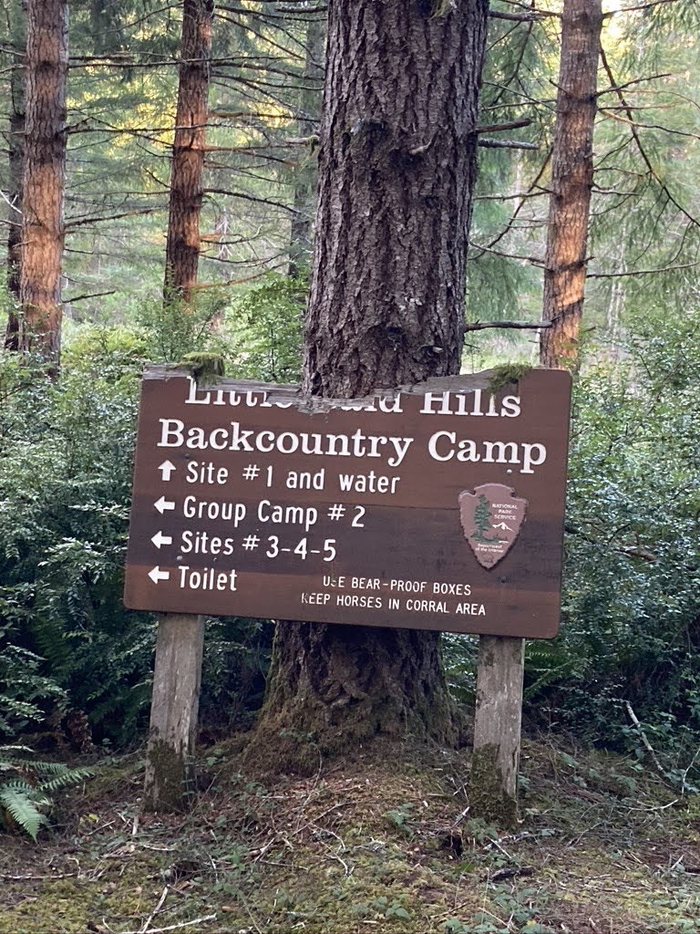
  • There are many camping options including a backcountry camp, developed campgrounds, dispersed camping, and the Bear Basin Butte USFS rental lookout
  • Two existing forestry fire lookouts provide spectacular views
  • The route utilizes a network of USFS gravel roads that are generally well maintained with several route options.  The route avoids major highways and is limited to less than 1 mile of highway travel.
  • There is year-round water throughout a majority of the route
  • Elevation ranges from sea level to just over 5,000 feet. Recommend riding from June to October due to potential for snow at higher elevations. Prime time is July to September to take advantage of warm temperatures and swimming opportunities
  • Summers are dry and warm with temperatures ranging from 80-100 F. The rainy season from October to April has an average annual rainfall of 90 plus inches
  • The route is climbing intensive with several extended climbs. Recommend ample mountain bike gearing and minimum 2” tires for the singletrack and some rough gravel sections.
  • Recommend 3-5 days, but your YMMV

Sunday, June 21, 2020

Somes Bar Gravel Loops

Distance:  20-50+
Elevation:  3,669’-7,000’+
Difficulty: Hard
Start:  Somes Bar, California

The Klamath National Forest near Somes Bar, CA, has miles and miles of backroads to explore as well as great campgrounds.  The Klamath and Salmon Rivers are a bonus for a great cool down after a long bike ride.  Plus there are remote backcountry campsites perfect for bikepacking or backpacking adventures.  Shown below are two loops that start and end in Somes Bar at the Somes Bar Outpost.  These are just two examples of the potential riding the area has to offer.  You could ride them in any direction, skipping, or adding the lookouts along the way.  I haven’t provided a ton of turn by turn directions so you can choose your own adventure.  I do recommend a gravel bike or a mountain bike with good climbing gears.  There are springs and streams along the way so bring your water filter.  Summer temps can reach into the 90s.


Offield Mountain Lookout (site) Loop

This 20 mile loop includes a few miles of Highway 96.  It can be completed clockwise or counterclockwise.  If you do it clockwise you will do the highway segment first, climb up gravel road 12N52, and descend on paved Camp Three road.  If you do it counterclockwise, the climbing is easier on the pavement, you descent gravel, but have to ride the highway back.  There are pros and cons to each way.  The Offield Mountain Lookout is an optional out and back (1.5 miles each way) with a steep grade up to the old lookout site. There is no longer a lookout at the location, just a rock monument.  There are however great views on the way up to the site. It makes a good picnic stop halfway through the ride.


Ukonom Lookout Loop

This 53 mile loop is tough with over 7,000 feet of climbing.  It would make a great overnight bikepacking trip.  There is a nice campground with picnic tables at Stanshaw Campground on the edge of the Marble Mountain Wilderness.  You could camp there and then hike into the wilderness from the trailhead located a the campground.  We did discover a slide at about road point 40, but you can safely walk across the creek.  The lookout is a permanent structure that is staffed during fire season.  It is a 4 mile one-way ride out to the lookout with a steep final climb.


Monday, June 15, 2020

Schoolhouse Peak Lookout

Distance: 38 miles
Climbing: 4546 feet
Dificulty: Moderate
Start: Orick 


Updated:  June 15, 2020.
Bald Hills Road has been upgraded with more pavement.  Now, only the last 2.3 miles are gravel to the lookout.  I still recommend a gravel bike to tackle the gravel road, but it could be completed on a road bike with tough tires if you are patient.  


A more challenging and fun ride is to start at the Prairie Creek Redwoods Visitor’s Center and incorporate the Davidson trail and Lost Man Creek trail.  For this route you would need a gravel bike or a mountain bike.  You have to ride on Highway 101 just over a mile to reach Bald Hills Road, but the route includes more gravel and trail.   


Original Ride Description:
The Schoolhouse Peak lookout is a great biking destination. It is a 38 mile out-and-back from Orick. I recommend you park in Orick at the Redwood National Park "South Operations" center office building. This ride does not require a complicated route sheet because there are only two turns. Head north on Highway 101 for 0.75 miles and turn right on Bald Hills Road. Restart your computer at the beginning of Bald Hills Road. Ride approximately 17.75 miles up Bald Hills Road and turn left onto the lookout road. There are many side roads along the way, but they are all gated, except for the one fork just past the Elk Camp fire station, where you stay right. You simply stay on the main road all the way up to the lookout. Along the way there are spectacular views from the road. During the climb up Bald Hills Road you will travel through old growth redwood and Douglas fir forest, natural prairies, and oak woodlands. The tallest tree in the world is located in the Redwood Creek drainage below Bald Hills Road. The park has been conducting broadcast burns to try to maintain the open prairies and oak woodlands. For more information, check out their website: http://www.nps.gov/redw/index.htm You will need a cyclocross, touring, or mountain bike with wide tires to be comfortable on the gravel roads. Thirteen miles up Bald Hills Road the surface turns to gravel. This results in a total of 10 miles of gravel road riding. I completed the ride on 32 mm smooth tires, but I would have been more comfortable on 35 mm or wider knobbies. The first 2.6 miles of the ride are steep. The road grade exceeds 15% in many locations, so I advise appropriate gearing for your fitness level.
  • 0- Start the climb up Bald Hills Road.
  • 2.57- Lady Bird Johnson Grove, bathroom, and hiking.
  • 9.89- Elk Camp CAL FIRE station. Stay to the right at the road fork.
  • 13- Start of gravel.
  • 17.75- Turn left to get to the lookout.
  • 18.21- Lookout
Click on the photo for a larger view. The park had conducted a prescribed burn to maintain the prairies and oak woodlands, which often get invaded by Douglas fir seedlings. View Larger Map

Wednesday, November 04, 2009

MTB- Orleans Mountain Trail

This is a special ride which takes an adventurous attitude. I'm not going to post directions or a map because I don't want anyone to get lost. Hopefully, some day I will if the trail conditions improve. There are a couple of tough hike-a-bike sections where the trail disappears and you need a guide or good GPS. For now, check out these fantastic photos from Errin Odell's and Sean Tetrault's recon mission. How does 5,000 feet of descending over 7 miles of singletrack sound?? Not only is the ride epic, but check out the scenery!


Click on a photo for a larger view


Friday, January 09, 2009

MTB- Grasshopper Peak Lookout

Distance: 14 miles
Climbing: 3350 feet
Difficulty: Moderate
Start: Humboldt Redwoods State Park, Weott

6.66 MILES TO THE TOP


This is one of those rides that you do once to check off your list. If you are deciding between this and Look Prairie/Thornton Loop, choose the later. This is because the climb is really steep and particularly aggravating. It might be worth it if there was 10 miles of sweet singletrack waiting for you at the top, but there is not. Maybe I was just having a bad day, but I saw my GPS read 30% a couple of times as I granny ringed it up a steep climb at 2.5 miles per hour. I cursed the climb and threatened to turn around more than once. When I got to the top my GPS read 6.66 EVIL miles. If you do this ride, please don't curse me, because I warned you! I rated the difficulty as moderate because of the steep climb, but it is a short ride and technically easy since it is all fire road.

Once you get to the lookout you have a 360 degree view. If you look to the east you will see signs of the 2003 Canoe fire, which started from lightning. The fire burned particularly hot near the lookout. There are many miles of roads to explore throughout the area if you want to extend your mileage. Most folks will settle for a fast ride back down the road. However, for the adventurous there are a couple of simple backcountry trail camping sites you could use. There is Grasshopper Trail Camp, Hanson Ridge Trail Camp, Whiskey Flat Trail Camp, and Johnson Trail Camp. For more information contact Humboldt Redwoods State Park

Directions to the start:

Start at the base of Grasshopper Road, which is located 5.25 miles west of Highway 101 on Bull Creek Road. There is a sign on Bull Creek Road which says "fire lookout 7 mi." The road is just west of the entrance to Albee Creek Campground. There is a small parking area on Bull Creek Road and and a small parking area a little way up Grasshopper Road. The directions to the lookout are well marked at each intersection. There are only three turns:
  • At 0.72 miles stay left at the intersection of Squaw Creek Ridge Rd.
  • At 4.14 miles stay right at the intersection of Johnson Trail Camp Rd.
  • At 6.33 miles stay right at the intersection of Grieg Rd.


Squaw Creek Bridge Crossing (Click for Larger View)


Saturday, October 04, 2008

Fire Lookouts

Why would I have a post about fire lookouts?

Because they make great biking destinations!
  • Adventure

  • 360 Degree Views

  • Difficult Ascents

  • Gravel Roads

  • Local History

I have compiled a list of 16 former and current lookouts in Humboldt County. Most of them would make great biking destinations, but I have narrowed the number down to 6 for several reasons. First, some, like Pratt Mountain, are located on private land and would require permission to ride to. Second, some no longer exist and are now just remote summit locations. Third, some are located in remote areas that I doubt many people would travel to just to ride a bike. I want to document lookouts that people would actually ride to. Below are the 16 potential lookouts. For some, I don't know if a lookout exists anymore. I have highlighted the ones that appear to make good biking locations. If you have been to one on the list for any reason, let me know if it would make a good ride by posting a comment. I'm particularly interested in confirming the lookout status and access.

  1. Big Hill, elevation 3583', Hoopa Valley Indian Reservation, location T8N, R5E, SEC 8, approximately 4 miles northeast of Hoopa. Permanent Lookout Station.

  2. Blake Mountain (LO site), elevation 5909', Six Rivers National Forest, location T3N, R5E, SEC 25, approximately 4 miles west of Hyampom. No longer a lookout.

  3. Board Camp Mountain, elevation 5191', Six Rivers National Forest, location T4N, R4E, SEC 27 , approximately 17 miles southwest of Willow Creek. No longer a lookout.

  4. Brush Mountain, elevation 3988', Six Rivers National Forest, location T6N, R4E, SEC 12, approximately 3 miles southwest of Willow Creek. Permanent Lookout.

  5. Cold Springs (LO site), elevation 5478', Six Rivers National Forest, location T2N, R6E, SEC 21, approximately 5.5 miles north of Mad River. No longer a lookout.

  6. Eightmile (LO site), elevation 4440', Six Rivers National Forest, location T2N, R5E, SEC 26, approximately 4.5 miles northwest of Mad River. No longer a lookout.

  7. Grasshopper Mountain, elevation 3379', Humboldt Redwoods State Park, location T2S, R2E, SEC 8, approximately 3 miles west of Weott. Permanent Lookout Station.

  8. Grouse Mountain, 5413', location T4N, R4E, SEC 1, approximately 13 miles south of Willow Creek. Private Land? Unknown lookout status.

  9. Iaqua Buttes, elevation 3729', BLM, location T3N, R3E, SEC 6, approximately 4 miles southeast of Kneeland Airport. Building on site in air photo. Private Property access?

  10. Mount Lassic (LO site), elevation 5400', Six Rivers National Forest, approximately 8 miles west of Ruth Lake. Unknown lookout status.

  11. Mt Pierce (LO site), elevation 3195', private property. No longer a lookout.

  12. Pratt Mountain, elevation 3895', location T4S, R4E, SEC 14, approximately 5 miles east of Garberville. Several structures including radio facilities. Supposedly a lookout built in 1930. No access, private.

  13. Schoolhouse Peak, elevation 3101', Redwood National Park, location T9N, R3E, SEC 19, approximately 11 miles southeast of Orick. Permanent Lookout Station.

  14. Shelton Butte (LO site), elevation 3568', Six Rivers National Forest, location T10N, R5E, SEC 20, approximately 5 miles northeast of Weitchpec. There is a structure on site (radio tower). According to the book Backcountry Adventures-Northern California, the lookout tower is no longer there.

  15. Sugar Pine Mountain (LO site), elevation 3942', Hoopa Valley Indian Reservation, location T8N, R4E, SEC 32. No longer a lookout.

  16. Orleans Mountain, elevation 6196', Six Rivers National Forest, location T10N, R6E, SEC 11, approximately 4.5 miles southeast of Orleans. Permanent Lookout Station. I have been to the lookout and it would make a challenging mountain bike ride. This is also located near Salmon Mountain, which is the highest summit in Humboldt County at 6957'.


View Larger Map