Showing posts with label Start- EastHum. Show all posts

Monday, February 13, 2023

Big Tanoak Loop

Distance: 22.7 miles

Climbing:  3304'

Difficulty:  Moderate

Start:  Salyer, CA

The ride starts on South Fork Road, 4.4 miles east of Willow Creek, or 1.1 miles west of Salyer.  There is a turnout on Highway 299 for river access where you can park. 

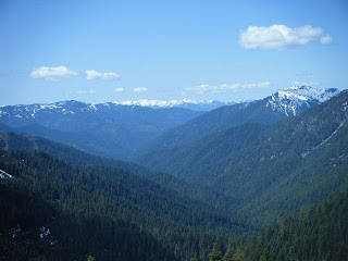
The ride starts straight off climbing up South Fork Road which is paved. You could do the loop either way, but this route is clockwise so you can get to the world's largest tanoak fastest, choosing an out-and-back, or continuing the loop. One you turn off South Fork Road to 6N12, it is all gravel despite the symbology of the map. The climb is steep in sections requiring mountain bike gearing or low gravel bike gearing. I had a 1x with 36x50. Typical 40x42 gravel gearing would be a grunt, especially on a few short 15% sections. A mountain bike would fun for the descents. There are some options for added distance such as heading out-and-back on the 5N02 to Hennessey Peak or riding out South Fork Road. There are a few terrific long-distance views along the route and some beautiful old growth Douglas-fir forest sections too. I noticed a few flowing streams along the route and one small pond where you could filter water. Otherwise, bring plenty of water during the summer.

The highlight of the ride is the world's largest tanoak. The tanoak was the new National Champion in 1991. At the time, the circumference was 22.5 feet (at 4.5 feet above ground), vertical height was 92 feet and average diameter crown spread was 82 feet.  You'll find the tree by following the ridewithgps route down the 6N31 to where the route stops.  Here there is a trail post and trail up above the road.  

https://ridewithgps.com/routes/42003518


Sunday, December 29, 2019

MTB- Tish Tang

Distance: 18
Climbing: 3,826 feet
Difficulty: Hard
Start: Willow Creek

UPDATE December 29, 2019
The trails have not seen regular maintenance and/or have been obliterated by logging.  The Corral trail, Shale trail, and Roller trail are unrideable.  The main roads are still open for a good gravel exploration ride and you can still  hit the downhill trail on the way back out.  I’m preserving the original text below, but be warned it has not been revised.

The Tish Tang DH and access road are on Trailforks but not on MTB Project.

This is a popular mountain bike ride, which is about an hour drive east of Arcata. The course is covers the majority of the expert race course from the old Tish Tang Mountain Bike Race. The trail was established and maintained for many years by Willow Creek mountain bike pioneer John Dostal.

To get to the start take Highway 299 to Willow Creek. Turn north onto Country Club Road, which is the cross street at the Chevron gas station. At 0.9 miles turn left on Patterson Road. Continue on the main road which will pass the Bigfoot Golf Course and wind its way into the forest. At 3.4 miles the road narrows so drive carefully. At 5.1 miles continue straight on Forest Service road 8N03 towards Horse Linto Campground. From this point on the road is poorly maintained. During the winter of 2008 a slide deposited on the road, which is still passable with a 4X4 vehicle or vehicle with good clearance. Horse Linto Campground is located next to Horse Linto Creek and is a simple pit toilet site with no running water. There are three campsites if you choose to spend the night in bigfoot country.

Listed below are some map points. The distance between each point is shown as well as the distance to some of the points from the Horse Linto Campground. Here is what each point represents:

1- Bottom of the downhill trail.
2- Bottom of the roller trail.
3. Intersection of the downhill trail.
4. Intersection of the 8N37 road.
5. Top of the roller trail.
6. Sign Board Gap.
7. Intersection with 7N09 road.
8. Intersection with 8N03T road.
9. Turn right on singletrack beyond the corral.
10. Bottom of singletrack and intersection with 7N09 road.

The most popular ride would be to climb the fire road all the way to the corral trail at point 9, descend down the corral trail to point 10, climb back up to point 7, descend to point 5 on the fire road, take the "roller trail" from point 5 to point 2, ride up to point 3, descend down the "downhill trail" to point 1, and return to the campground. This would give you a total of 18.2 miles and 3826 feet of climbing. However, there are several other trails that are worth checking out. The shale trail is accessed from sign board gap on the 8N14 road. The upper section is steep with a loose shale surface which is very challenging. The upper downhill course is steep and challenging as well. I don't highly recommend it because of its steepness and low frequency of maintenance.


Tish Tang A Tang Map Overview, Click on the image for a larger view or to print it out in landscape view:


Horse Linto Campground:


The top of the roller trail is difficult to find because of recent logging. Look for a large oak tree with a burned out hollow in the base. Head straight downhill to the right of the oak tree and you will pick up the singletrack.


At the top of the corral trail you will enter an old growth Douglas-fir forest:


The main fire road has seen little to no maintenance by the Forest Service and is starting to revert back to nature. At some point we are going to have to clear the main road too:

Friday, September 09, 2011

Forks of Salmon Loop


Distance: 100 miles
Climbing: 10,000
Difficulty: Epic
Start: Forks of Salmon or Etna


The Salmon River Loop is a beautiful low traffic century in Siskiyou county. Here's a link to the Siskiyou Velo route description

We completed the ride in a clockwise direction starting at the Forks of Salmon Post Office. This is an easier way since you hit the toughest climb first. We also had the luxury of stopping for lunch at the Etna Brewery!


If you start in Etna you have to tackle the most difficult climb last after a long hard day. This ride rates as an epic, just like the Tour of the Unknown Coast. The scenery is spectacular and it is a must do for any north coast cyclist, even if the start is 2 hours from the coast. Traffic is generally light until you reach Highway 3, which you won't mind at all. In fact, at one time our squirrel count was higher than our car count!

The route would also make an excellent tour with several campgrounds along the way.


I have not provided a detailed route description because the ride can be started anywhere along the loop and there are few turns and lots of road signs. We started in Forks of Salmon, took Sawyers Bar Road to Etna, Highway 3 towards Callahan, and Callahan/Cecilville Road back to Forks of Sallmon.


Forks of the Salmon Loop


Sunday, August 29, 2010

Nordheimer Trail Loop

Distance: 24 miles
Climbing: 3,763
Difficulty: Hard
Start: Nordeimer Campground

This ride is hard to categorize. The ride isn't hard because of the climbing or distance. The challenges are numerous including stream crossings, unrideable switch backs, hike-a-bike sections, skinny single track, mosquitoes, rattle snakes, poison oak, and true isolation. Once you drop into the Nordheimer canyon you are really in the middle of nothing where you would be in real trouble without a partner or survival skills. The best way to describe this is an adventure ride. All of the challenges are worth the beauty, isolation, and satisfaction of completing the ride.


If you are going to do this ride I have a few recommendations. First, don't do it alone. Once you drop into the Nordheimer canyon there are only two ways out and that is up or down the trail. Second, bring a few extra items like extra water, food, clothes, and a good map and/or GPS. The mosquitoes were swarming us in August so I recommend some type of bug repellent if you plan on staying in one place for a more that a couple of minutes. Third, plan on doing this ride in the late summer or fall. The stream crossing are difficult to negotiate in the winter and spring due to their large size and no bridges. You will be challenged to keep you feet dry even in the summer or fall.

The route involves 4 miles of road, 12 miles of fire road, and 8 miles of singletrack. Believe it or not, but the 8 miles of single track will take longer to ride than the other 16 miles even though you are descending over 2,000 feet along the way. The first single track section involves some steep narrow trail where you will be skidding your back wheel downslope. The next few miles involves narrow single track that requires intense focus to stay on track. The last 3 or so miles follow an old mining flume, which parallels the slope and rewards you after a challenging day.


Directions
0- Start at Nordheimer Campground. If you want to avoid the day use fee drive about 100 yards up the Nordheimer road and park in a turnout at the base of the Orleans Mountain Trail. Head up the Salmon River to Forks of Salmon.
4.0- Turn right onto Cecilville Road.
4.25- Turn right onto Forest Service Road 10N04. Stay on this main road for the next 6 plus miles.
10.7- Continue right onto Forest Service Road 10N03.
11.9- Turn right onto Forest Service Road 10N05.
15.54- ***Turn left onto the Nordheimer Trail. This is an important and difficult turn. The trail is not marked with a sign and it is not obvious. We piled some branches and rocks in the road. The only way Errin Odell found it was by hiking from the bottom. There are no intersections going down the trail, but there are a few places where the trail disappears near the stream crossings.
24.25 End at Nordheimer Campground.


Additional Trail Photos are HERE

Wednesday, November 04, 2009

MTB- Orleans Mountain Trail

This is a special ride which takes an adventurous attitude. I'm not going to post directions or a map because I don't want anyone to get lost. Hopefully, some day I will if the trail conditions improve. There are a couple of tough hike-a-bike sections where the trail disappears and you need a guide or good GPS. For now, check out these fantastic photos from Errin Odell's and Sean Tetrault's recon mission. How does 5,000 feet of descending over 7 miles of singletrack sound?? Not only is the ride epic, but check out the scenery!


Click on a photo for a larger view


Monday, September 15, 2008

MTB- Bremer Boy Scout Trail

Distance: 9 Miles
Climbing: 2342 Feet
Difficulty: Moderate
Start: Willow Creek


UPDATE December 29, 2019

I can’t recommend this ride anymore.  It was obscure when I road it 10 years ago.  Since then there has been no trail maintenance and the access road is sketchy due to cultivation activities.  I could just delete the post but I’m leaving it up.  Who knows, maybe a scout troup will maintain the trail from the bottom so it can be hiked.

The "Boy Scout Trail" is a little known mountain bike ride just above the Bigfoot golf course in Willow Creek. The 2.21 mile singletrack trail is named the "Boy Scout Trail" because it was adopted by Boy Scout Troop 97 of Willow Creek. However, it has only been sporadically maintained over the years by local mountain bikers. The trail was maintained for several years by Willow Creek mountain bike pioneer John Dostal, but has recently fell into disrepair and is seldom used. The upper portion of the trail is blocked because of serious snow damage, which has left a dense layer of young hardwoods in the way. I had to do some serious bushwhacking to find my way. The top of the trail is marked by a small brown sign, which currently has no marking, but used to say Bremer trail. The trail is accessed by the unmarked Forest Service 7N05 road, which crosses private property. There are several new gates and a lot of no trespassing signs. Stay on the main road and follow the map points and you can access the trail. If you run into a locked gate, you have gone the wrong way, except at mile point 5.5 where you want to continue straight through the gate near the Forest Service boundary. The climb is steep and relentless. Bring along your granny gear and expect to use it from mile point 2.8 to the top at 5.9 miles. However, the singletrack is truly unique. The trail is only a foot or so wide, covered in leaf litter, and has several sharp switchbacks that only the "Hans Rey" type could clean. There are a couple of tricky points where the trail disappears in the heavy leaf litter. I hope to improve the trail signage in the future and clean up the top section so it will not be lost to the forest.

To get to the start take Highway 299 to Willow Creek. Turn north onto Country Club Road, which is the cross street at the Chevron gas station. At 0.9 miles turn left on Patterson Road. After 0.5 miles turn right onto Bigfoot Ave and park at the Bigfoot Golf Course on the left. To begin the ride, head back to Patterson Road and follow it north to the 2.8 mile mark where you turn right and begin climbing the gravel fire road.

Overview Map, click on the image for a larger view and to print out in landscape view:


Southern Detail Map, showing the Bremer Boy Scout Trail: